The Northern Bellarine coastline is a highly dynamic environment susceptible to coastal processes that drive erosion. In an effort to mitigate the consequences of erosion, Bellarine Bayside implements strategic best management practices across the coastline. Project evaluation is an important component of this work which requires a monitoring program to be undertaken.
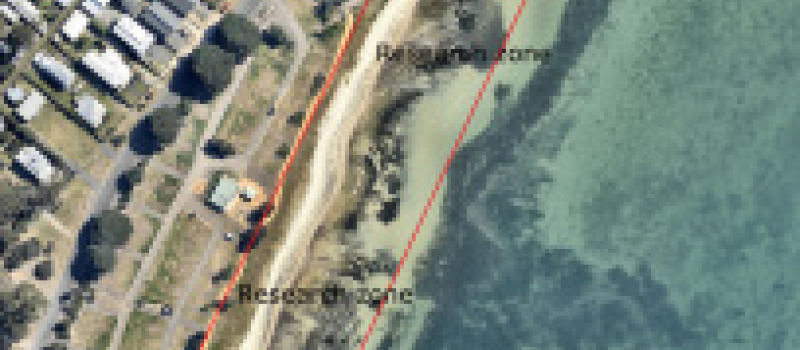
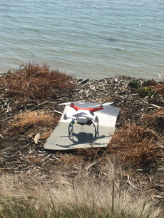
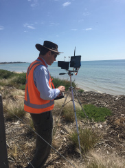
A 2014 beach renourishment site adjacent to Bengalat Reserve (formerly Area 3) will provide the setting for the state-of-the-art monitoring program by two independent consultants. Using an unmanned aerial vehicle (drone), photos will be taken of the coastline to build a current beach profile for comparison with the 2014 data set. This assessment will enable Bellarine Bayside and DELWP to better understand the processes that shape our coastline and the efficacy of our management protocols.
Consequently, the section of beach between Bengalat Reserve and the St Leonards Tennis Club will be closed briefly to the public on Monday, 1 February 2016 from 1:00pm (weather-dependent) in an effort to ensure a safe and successful unmanned aerial vehicle flight.
If you would like to learn more about the monitoring process, please feel free to come along and watch from our designated observation point. Contact our Coastal Projects Officer Leia Howes on 5254 4010 or leia.howes@bellarinebayside.com.au for further information.
If you would like regular updates on projects such as this and other Bellarine Bayside activities please subscribe to our e-News here.


